
Walk a Lafayette Street Record
A sound address search moves from the map to the documents. Tippecanoe County property tools can identify the parcel and owner of record, but ownership alone does not prove who sleeps there. Deeds explain transfers. City permit files show work tied to a site. A voter record, when lawfully obtained, may support a current address for one named voter, while an old criss-cross volume can identify a past listed occupant. The Lafayette street directory works best when each source answers only the question it was built to answer.
- Enter the house number and street in Schneider Beacon. Save the parcel number, situs address, owner name, and mailing address.
- Open the Tippecanoe County GIS viewer. Select the parcel and compare it with the lots on both sides.
- Check the Treasurer tax search by parcel, name, tax year, or property address. Treat its result as a dated account snapshot.
- Use the owner name in Recorder records to follow deeds. The Recorder cannot locate a deed by street address over the phone.
- Use lawful voter access or a library criss-cross directory only as a separate check on occupancy. Record the year of every match.
This sequence also guards against a common error: attaching the owner's mailing address to the Lafayette parcel as though both were the same place. Keep the situs address, which is the physical site, separate from the address where a tax bill goes.
Lafayette Street Search Fields
The county links residents to Beacon for public assessment and tax data. If the web service is down or a result is hard to read, public computers are available in the Auditor's second-floor office at 20 N 3rd Street. That counter route matters because the street directory should not depend on one vendor page. The county also directs questions about assessment to the Assessor and deduction matters to the Auditor.
| Search key | Use in Lafayette | Check before relying |
|---|---|---|
| Property address | Find a known house number and street | Match the situs address and parcel |
| Owner name | Find other parcels under the same recorded name | Separate people with similar names |
| Parcel number | Carry one property across tax, GIS, and deed work | Copy the full identifier |
| Mailing address | See where county notices are sent | Do not call it proof of occupancy |
The county says assessment reflects factors such as size, construction, amenities, and comparable sales. Those facts help confirm that two records describe the same structure. They do not identify every Lafayette resident at the address.
The county property-access instructions show the official path into this system. The captured page below makes a useful checkpoint before a user leaves the county site for Beacon.

That county page also preserves the in-person fallback, which is often the best way to resolve a weak address match.
Map Lafayette Streets in GIS
The county's General Viewer guide documents searches by address, owner name, parcel number, intersection, subdivision, and point of interest. The map can display parcels, address points, roads, subdivisions, precincts, ZIP areas, zoning, aerial imagery, and other public layers. Selecting a parcel opens its attributes. The tool also supports measuring and printing, while a property link can move the search into Beacon.
For a whole named street, zoom to one confirmed parcel and pan along the road. Select each adjacent lot rather than assuming the next house number belongs to the next parcel. Corner lots, split tracts, condos, and vacant land can break that pattern. County GIS also takes custom map and list requests, including distance-from-feature work, with prices stated as starting at $25. Call 765-423-9357 when a standard map cannot produce the needed layout.
Map tip. GIS is planning and reference data, not a survey; confirm a boundary or legal description in the recorded plat or deed.
Lafayette Records Keyed by Address
No single roll supplies a full Lafayette household. The practical coverage comes from several custodians, and each channel has a useful fallback. Online parcel and tax tools lead current property work. The Recorder counter, paid index routes, city permit portal, Election Board request process, and local history rooms fill different gaps.
| Address source | Local keeper | What it can establish | Access route |
|---|---|---|---|
| Assessment and parcel map | Tippecanoe Assessor and GIS | Owner, situs, parcel, lot context | Beacon, GIS, public computer |
| Tax account | Tippecanoe Treasurer | Name, address, parcel, tax year | Free web search or office help |
| Deeds and mortgages | Tippecanoe Recorder | Recorded parties and title transfers | Laredo, Tapestry, counter, mailed copy |
| Permits and inspections | Lafayette Community Development | Applicant, contact, work, status | Citizen Self Service or APRA request |
| Voter registration | Tippecanoe Election Board | Approved public fields for registered voters | Single-voter portal or VRG-24 request |
| Criss-cross directories | TCHA and TCPL | Listed occupant and phone by old address | Archive, library, lookup help |
The best common key is the parcel number for county property records and the exact street form for city and historical sources. Keep both. If the modern address fails in an older volume, search the same block, a former place label, or a rural route form.
Deeds Along Lafayette Streets
The Tippecanoe County Recorder maintains deeds, mortgages, easements, assumed business names, federal tax liens, and other recorded instruments. The ordinary county page says online data and images run from January 16, 1970 to the present. A separate Laredo subscription agreement states that images reach back to 1826. Those claims describe different services and should not be merged.
Tapestry is the occasional-use route at $8.95 per search. Laredo uses monthly plans and charges $1 per printed page. The Recorder counter is the direct fallback, and mailed copies are $1 per page with $5 added for certification. A copy request needs an instrument number or book and page. Staff state that they cannot search by address or provide recording details by phone, so convert the address to an owner name and parcel first.
One deed names parties to a transfer, not the full Lafayette household. It may also use a legal description rather than a street number. State tax liens and judgments belong with the Clerk, while the Recorder keeps federal tax liens. A street directory that needs a full lien picture must not treat one office as complete.
Lafayette Permits by Street
Lafayette Citizen Self Service ties permit and inspection records to a street address or application reference. The city instructions say to enter the house number and street name, then use status boxes and the Details, Plan Reviews, and Comments views. A result may name an applicant, primary contact, contractor, or owner, but that role does not prove residence.
Open the Lafayette permit and inspection search before using an APRA request. The image below shows the portal assigned to this Lafayette street directory.
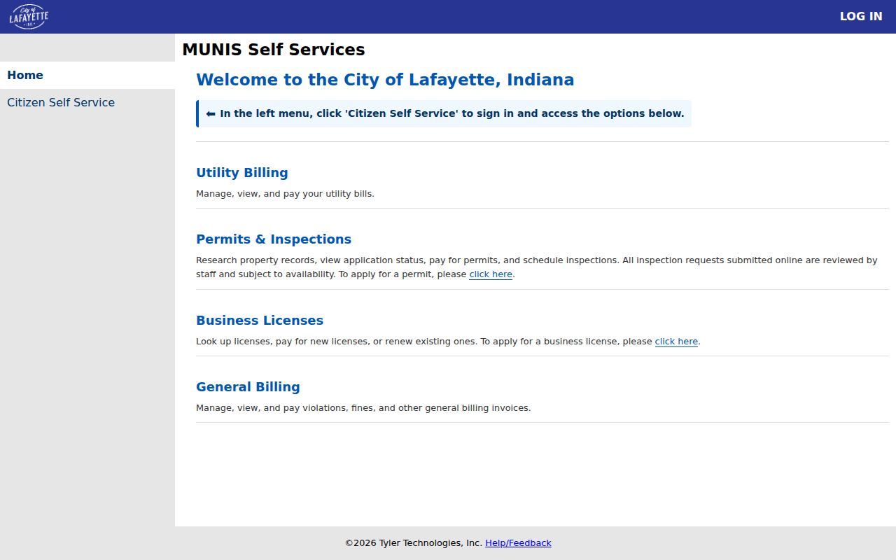
When the portal has no public result, use the city records request route and name the department, address, record type, and date range. Inspection at a city office, a phone inquiry, or a written request can also clarify where an archived permit is held.
Lafayette Voters Are Not a Roster
The Indiana voter portal checks one known voter through name, date of birth, and county. It is not an open search for everyone at one Lafayette address. Broader voter-file access uses the VRG-24 application through election officials and comes with purpose, handling, fee, and restricted-field rules. The Tippecanoe Election Board is at 20 N 3rd Street and can explain the current request process.
Indiana protects some voter information, and participants in the Address Confidentiality Program can have address flags. Never treat a missing voter result as proof that a person does not live on the street. They may be unregistered, recently moved, protected, entered under a different form of the name, or simply not matched by the single-voter tool.
Older Lafayette Address Labels
Lafayette was founded in 1825, and the county followed in 1826. Canal, rail, Monon Shops, industry, and later growth shaped the street grid. Historical directory guides preserve labels that can confuse a modern address search: Chauncey is now West Lafayette, while Elston is now part of Lafayette. Rural routes and locality abbreviations also appear in older volumes.
The Tippecanoe County Historical Association's directory inventory includes address-to-occupant criss-cross runs from 1927-28 and 1929-30, plus many later years through 2007 with gaps. For older households, use the Lafayette city directories rather than forcing a current street spelling into every decade. The directory year and abbreviation key are as important as the name hit.
Annexation and street changes can also place a historic site outside the record office a user expects. Search the historical place label, the present parcel, and nearby house numbers before deciding that an address vanished.
Lafayette Street Record Terms
Four terms keep an address chain clear. Define them before saving notes, especially when one Lafayette street crosses subdivisions or contains several parcel types.
- Parcel
- A mapped unit of land with its own county identifier. One street address can involve more than one parcel.
- Situs address
- The physical location assigned to the property, which may differ from the owner's mailing address.
- Plat
- A recorded map that lays out lots, blocks, streets, and easements in a subdivision.
- Criss-cross directory
- A directory arranged by street and house number so an address can lead to a listed occupant or phone.
Limits of Lafayette Street Records
Public property tools tend to identify an owner, not each renter, child, relative, guest, or other occupant. A permit applicant may be a contractor. A deed party may never have lived at the site. Tax mail can go elsewhere. Voter records cover only eligible people who registered and remain subject to Indiana restrictions. Utility customer data and motor vehicle address data are not general public household lists.
Use dates and roles. State that a person was the assessed owner, recorded grantor, permit applicant, registered voter, or listed directory subscriber at a given time. Do not turn any of those precise facts into the broader claim that the person is a current Lafayette resident without separate support.
Lawful use. Use Lafayette address records for legitimate personal research and civic inquiry, never to stalk, harass, threaten, or harm a person.